Aerial Inspections And Aerial Surveys Produced By Drones
Aerial Filming and Photography Services
Specialist Services:
Philip Fearnley and Halo Vue Aerial Photography specialize in providing aerial filming and high-quality aerial photography by drone especially equips for drone surveys.
Client Base:
Often commissioned by specialist surveyors and building companies.
Years of Experience:
Have been in the industry for many years, offering expertise and reliability.
Collaboration with Clients
Close Collaboration:
We are not building surveyors, we are a drone data capture company
Remote Monitoring:
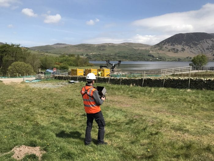
Utilises remote screens on site for clients to monitor flights.
Flexible Direction:
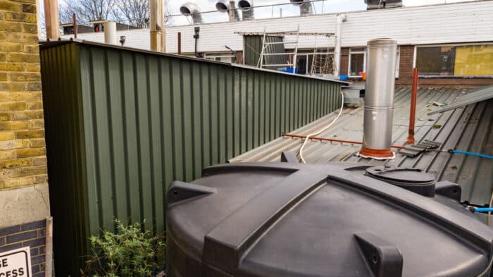
Drones can be directed to hard-to-reach parts of buildings removing the need for scissor lift and cherry pickers. Increased Safety for workers.
Trusted Partnership
Client Trust:
Trusted by major clients to capture the required images.
Autonomous Operations:
Often conducts missions without the client’s physical presence, saving their time and money.
High-Quality Drone Camera
Utilizes high-quality drone camera sensors.
Zoom facility magnifies up to 28 times.
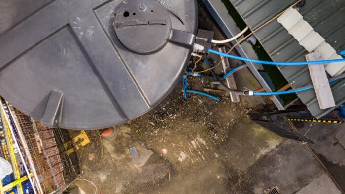
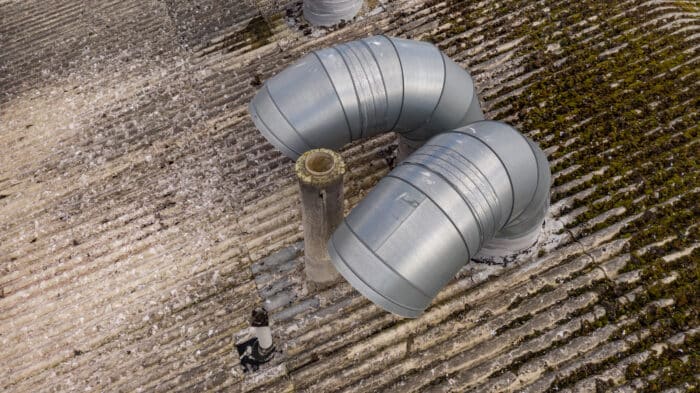
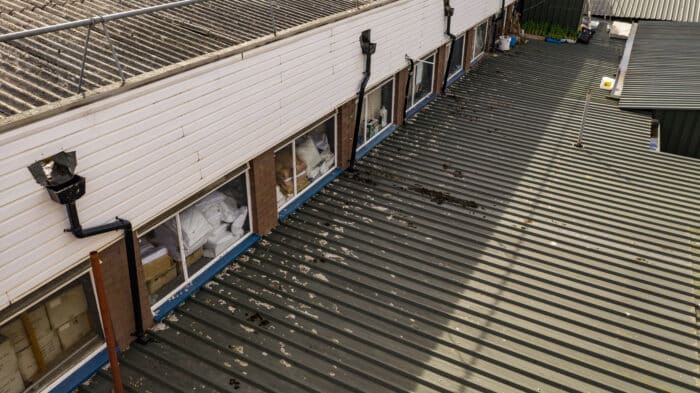
Detailed Drone Images
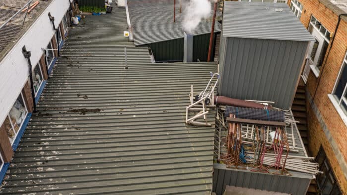
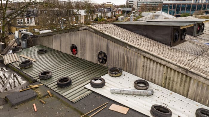
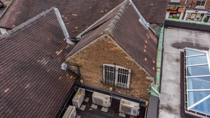
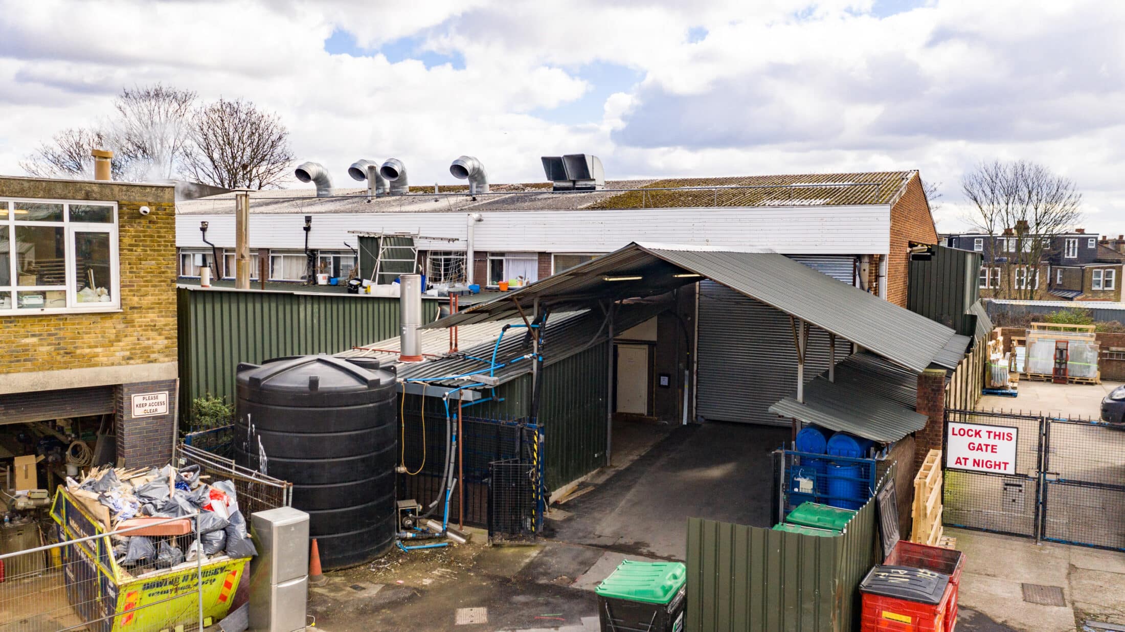
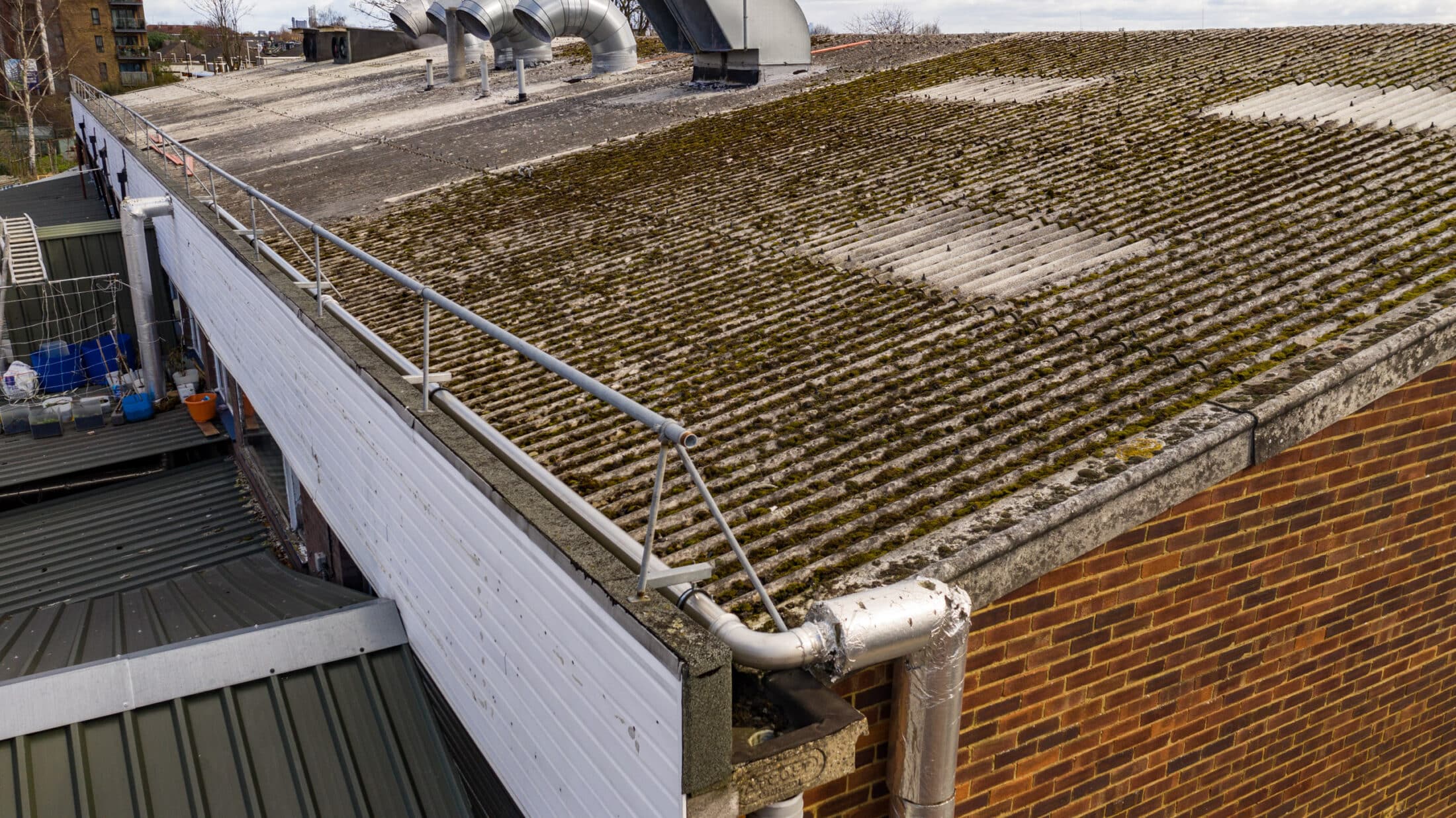
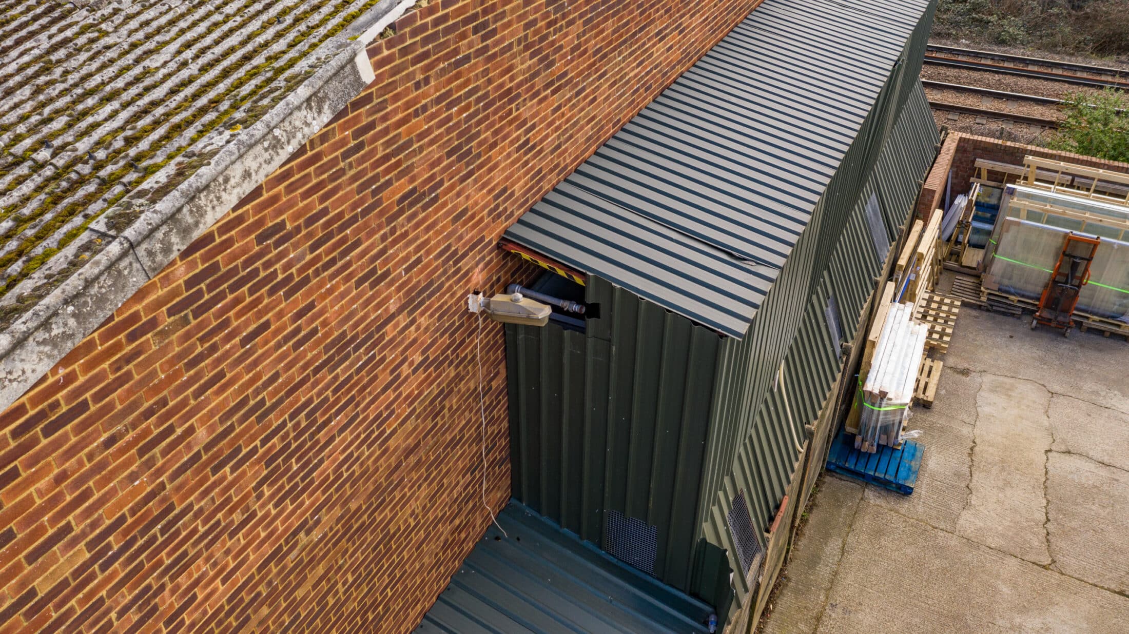
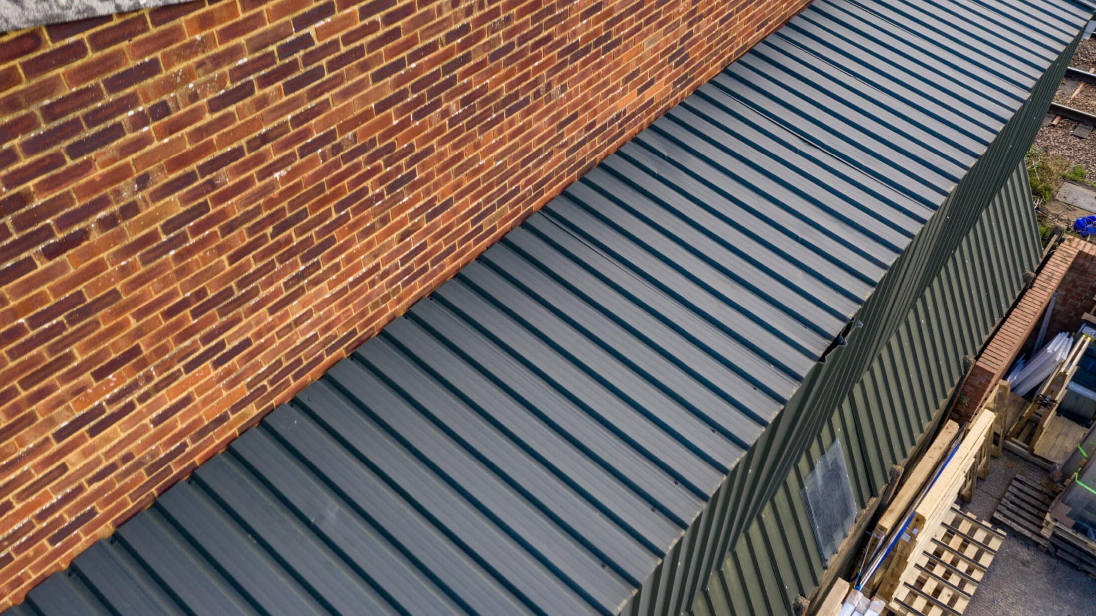
Films areas of buildings from safe heights.
Captures detailed drone images.
Image Processing
All images photographed as raw files.
Unlimited images processed to JPEG format.
Delivered to the client usually on the same day.
Comprehensive Drone Films
Customised films including clients logos and graphics.
Supplies comprehensive drone films of required areas.
Efficient Viewing
Offers a faster way to view surveyed areas.
Avoids the need to scroll through individual still images.
Easy Sharing
Easily shareable with other members of the client’s team
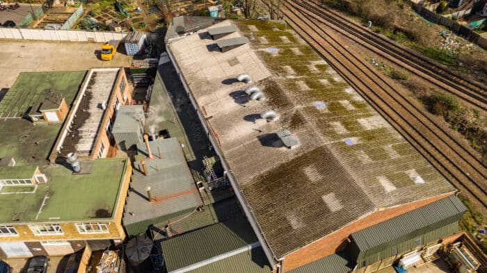
Revolutionizing the Building Industry
Drones have transformed operations in the building industry.
Reduces time spent on ladders and scissor lifts for accessing heights.
Enhanced Safety
Decreases risks associated with accessing heights.
Minimizes potential dangers and costs.
Efficiency
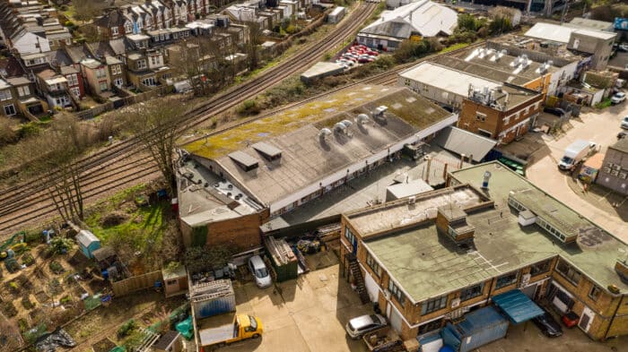
Large industrial roofs can be photographed and filmed in a few hours.
Final image output can be completed on the same day.
Preparation and Assessment
Full RAMs and risk assessments are produced prior to being on site.
Conducts pre-flight surveys using Google Earth or by attending the site in advance.
Risk Mitigation
Identifies potential issues such as proximity to roads, people, schools, airports, and prisons.
Develops action plans to address identified risks.
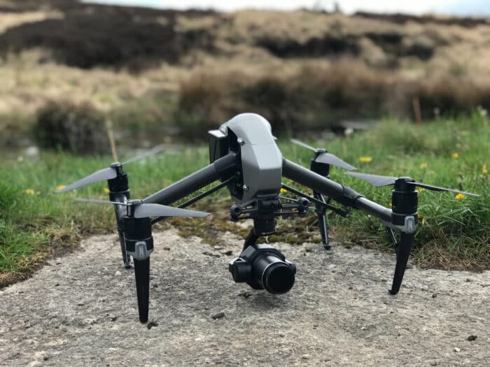
Aircraft Selection
Chooses appropriate aircraft for the job.
Options include the Mavic 3 Pro with impressive zoom capabilities and the DJI Mavic Mini 3 for flying in densely populated areas with fewer restrictions
Aircraft Maintenance
Aircraft are fully serviced before each drone filming shoot.
Servicing is logged on the Airdata platform.
Drone Monitoring
Airdata platform records every flight.
Informs the pilot of any past issues with the drones.
Monitors drone battery health, altitude, speed, and distance flown.
Regulatory Compliance
Flights are logged as per CAA requirements.
All servicing is recorded to maintain licensure.
Battery Management
Sufficient power and batteries for a full day of flying.
Allows for breaks and recharging in the vehicle.
Operational Efficiency
Capability to photograph multiple properties in a single day.
Offers an attractive alternative to traditional survey methods.

